-
Rand McNally Historical Atlas of the World
Rand McNally
Perfect Paperback (Rand McNally, July 31, 2015)The Historical Atlas of the World presents important periods and turning points in 5,000 years of world history in over 100 pages of thematic maps. Atlas features: 2015 copyright updated to include recent world events like the Arab Spring & changes in U.S. relations with Cuba Presents major periods of world history through more than 100 bold, colorful maps Thematic maps include literacy, languages, religions, and more Includes a section on benefits of using the atlas 112 pages, paperback, 8" x 10"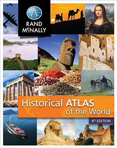
-
Rand McNally Atlas of World Geography
Rand McNally
Paperback (Rand McNally, May 31, 2017)Rand McNally's Atlas of World Geography provides engaging and richly illustrated geographic information for secondary students from grades 6-12. Thematic maps, graphs and charts help present a more complete portrait of our physical and political world. Atlas of World Geography features: 85 pages of detailed physical and political maps Engaging illustrations, photography, and infographics 35 pages of human and physical world geography maps, graphs, charts, including information on plate tectonics, climate, environments , population and economics Updated Countries section including flag, capital city, area and population Glossary of foreign terminology plus comprehensive index to enrich and maximize use of maps Special continent sections exploring landforms, land cover and use, climate, and continent specific issues and current events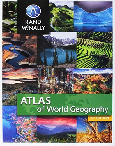
-
Rand McNally Atlas of World Geography
Robert E. Gabler
Paperback (Brooks Cole, June 15, 1999)Comprehensive and current, the atlas can be packaged with the text for a nominal fee.
-
Rand McNally Atlas of the World: A millennium edition
Rand McNally
Hardcover (Metro Books, Sept. 15, 1999)From the premier publisher of maps and atlases for more than 100 years comes this comprehensive, authoritative, and oversized guide to the world. It includes 150 pages of rich detailed maps of the world, updated to reflect recent political changes. Enhanced coverage of the United States features a special section with individual maps of all 50 states. An introductory section contains a primer on cartography and the basics of map-reading; "The Real World," which provides an in-depth look at world climate, populations, people, and countries; and a time zone map of the world. For research, for homework, for trip and vacation planning, for following current events anywhere on the globe, or even for armchair travel, this atlas makes an invaluable addition to any home library.
-
Atlas of the World
Oxford University Press
Hardcover (Oxford University Press, Nov. 4, 2004)Eleven years ago, the first edition of Oxford's Atlas of the World was met with praise for the incredible beauty and accuracy of its maps as well as for its wealth of geographic data, and each successive edition only collects more accolades. The New York Times Book Review called it a "veritable encyclopedia of geographic and demographic information, profusely illustrated with multicolored maps and graphs," and the Baltimore Sun exclaimed that the newest edition was nothing less than "a magnificently produced example of quality publishing." Replete with 67 maps of cities worldwide, the 12th edition charts the key urban centers of each continent from Athens, Greece (including its new airport) to Wellington, New Zealand. As in past editions, the Atlas has been completely updated to reflect the changing world around us. Refined name forms in Malaysia and South Africa, the addition of a new state in Indonesia, extra name detail in the Atlantic and the Pacific Oceans and dozens of other improvements make this the most reliable atlas on the market. The unique Gazetteer of Countries adds a yet another quick reference tool to a book already teeming with useful information. Several new features further enhance the 12th edition. Interstate and state highways are now shown throughout North America, putting the overall precision and clarity of the book well ahead of the competition. A Glossary of Geographical Terms will be an enormous asset to those unfamiliar with foreign terminology while the colorful Introduction to World Geography--redesigned and beautifully illustrated with tables and graphs--provides informative summaries of topics as diverse as climate, global warming, plate tectonics, international conflicts, agriculture, trade, and population. What's more, detailed explanatory captions accompany the section of full-page satellite images that Library Journal called "stunning." Offering the finest global coverage available, the Atlas of the World sets the standard in atlas quality, living up to its reputation as an "indispensable reference," granted by NBC's Weekend Today Show.
-
Atlas of the World
Oxford University Press
Hardcover (Oxford University Press, Oct. 1, 2016)The only world atlas updated annually, guaranteeing that users will find the most current geographic information, Oxford's Atlas of the World is the most authoritative atlas on the market. Full of crisp, clear cartography of urban areas and virtually uninhabited landscapes around the globe, the Atlas is filled with maps of cities and regions at carefully selected scales that give a striking view of the Earth's surface. It opens with a fascinating look at world statistics and 18 pages of stunning satellite images, all sourced from NASA's latest Earth Observation Satellite, Landsat 8. The extraordinarily extensive front matter continues with a "Gazetteer of Nations" that has been comprehensively checked and updated to include recent economic and political changes, and a 48-page "Introduction to World Geography," beautifully illustrated with tables and graphs on numerous topics of geographic significance, such as the geology and atmosphere of Earth, food and water supply, biodiversity, energy, global conflict, human health, and standards of living. The hundreds of city and world maps that form the body of the Atlas have been thoroughly updated for this 23rd edition.Providing the finest global coverage available, the Atlas of the World is not only the best-selling volume of its size and price, but also the benchmark by which all other atlases are measured.
-
Atlas of the World
Oxford University Press
Hardcover (Oxford University Press, Nov. 1, 2017)The only world atlas updated annually, guaranteeing that users will find the most current geographic information, Oxford's Atlas of the World is the most authoritative atlas on the market. Full of crisp, clear cartography of urban areas and virtually uninhabited landscapes around the globe, the Atlas is filled with maps of cities and regions at carefully selected scales that give a striking view of the Earth's surface. It opens with a fascinating look at world statistics, a six-page special on "Land and Maritime Boudaries," and satellite images of earth, including 8-10 stunning new images sourced from NASA's latest Earth Observation Satellite, Landsat 8, launched in 2013. The extraordinarily extensive front matter continues with a "Gazetteer of Nations" that has been comprehensively checked and updated to include recent economic and political changes, and a 48-page "Introduction to World Geography," beautifully illustrated with tables and graphs on numerous topics of geographic significance, such as climate change, world religions, employment, industry, tourism, and travel. The hundreds of city and world maps that form the body of the Atlas have been thoroughly updated for this 24th edition.Providing the finest global coverage available, the Atlas of the World is not only the best-selling volume of its size and price, but also the benchmark by which all other atlases are measured.
-
Rand Mcnally Atlas of the World
Rand McNally Staff
Paperback (Rand McNally, Aug. 16, 1997)Includes 58 pages, copyright 1995, 2nd printing 1997, 8.5" x 11" format paperback.
-
Atlas of the World
Oxford University Press
Hardcover (Oxford University Press, Oct. 1, 2014)The only world atlas updated annually, guaranteeing that users will find the most current geographic information, Oxford's Atlas of the World is the most authoritative atlas on the market. Full of crisp, clear cartography of urban areas and virtually uninhabited landscapes around the globe, the Atlas is filled with maps of cities and regions at carefully selected scales that give a striking view of the Earth's surface. It opens with a fascinating look at world statistics, a six-page special on "The Future of the Oceans and Seas," and satellite images of earth, including eleven stunning new images sourced from NASA's latest Earth Observation Satellite, Landsat 8, launched in 2013. The extraordinarily extensive front matter continues with a "Gazetteer of Nations" that has been comprehensively checked and updated to include recent economic and political changes, and a 48-page "Introduction to World Geography," beautifully illustrated with tables and graphs on numerous topics of geographic significance, such as the geology and atmosphere of Earth, food and water supply, biodiversity, energy, global conflict, human health, and standards of living. The hundreds of city and world maps that form the body of the Atlas have been thoroughly updated for this 21st edition.Providing the finest global coverage available, the Atlas of the World is not only the best-selling volume of its size and price, but also the benchmark by which all other atlases are measured.New to this Edition:� Eleven stunning new satellite images, all sourced from NASA's latest Earth Observation Satellite, Landsat 8, launched in 2013� Fact panels, flags and text comprehensively checked and updated to include recent economic and political changes� Climate Change and Global Warming spread updated in line with findings from the Intergovernmental Panel on Climate Change� Updates to the depiction of the borders between Crimea and Ukraine, and between Crimea and Russia� Politically-colored maps of Crimea show disputed borders� New graphics on rising sea-levels and Arctic sea ice� New feature on the value of ecosystems� Adds museums; Hermitage, Spaarpotten, and Allard Pierson in Amsterdam, Bangkok Art and Culture Centre, Neues Museum in Berlin, Gulbenkian Museum in Lisbon, Design Museum and Saatchi Gallery in London, and the P�rez Art Museum in Miami� Adds new subway stations in Beijing, Budapest, and Delhi� Adds light railway in Jerusalem and tram route in Edinburgh� Renames Budapest International Airport� Shows changes to street names in Cape Town (eg Nelson Mandela Boulevard)� Adds new road tunnel in Istanbul joining Asia and Europe� Adds new suburb name Hudson Yards and High Line elevated garden in New York� Adds extra suburb names to Atlanta, Seoul, and Toronto� Shows new suburbs and areas of reclaimed land to Singapore� Shows Hornindalsvatnet in Norway, Europe's deepest lake� Adds new national parks; Sierra de Guadarrama in Spain, Gallipoli in Turkey, and Kumbhalgarh in Rajasthan, India� Shows reduced extent of Lake Urmia in Iran and Lake Razzaza in Iraq� Shows major new rail links between Iran and Kazakhstan and between Iran and Azerbaijan� Adds the world's most northerly railway line in the Yamal Peninsula, Russia� Adds Longtan Reservoir in Southern China and Tekeze Reservoir in Ethiopia� Shows new provinces; Monza and Brianza in Northern Italy, Davao Occidental in the Philippines, Kalimantan Utara in Indonesia, Rangpur in Bangladesh, Alborz in Iran, and Jiwaka and Hela in Papua New Guinea� Adds major new ports; Ambarli in Turkey, Songdo in South Korea, Laem Chabang in Thailand, Johor Port in Malaysia, Ra's Al Khair in Saudi Arabia, Morgan's Port in Texas, and Itaguai near Rio de Janeiro� Names new cities Iskandar, Malaysia and Masdar City, near Abu Dhabi� Adds new resorts in Southwest Burma - Chaungtha and Ngwesaung� Shows Telangana in regional type, pending ratification of statehood by Indian Congress� Adds new high speed rail lines under construction between Tel Aviv and Jerusalem, and between Rio de Janeiro and Sao Paulo� Shows rail under construction between Kaduna and Abuja, Nigeria� Shows new administrative subdivisions in Oman, Kenya, Tanzania, Namibia, and Madagascar� Shows major ore exporting ports; Cape Lambert in Western Australia and Puerto Bolivar in Colombia� Shows new heights for Aoraki Mount Cook and Mount McKinley (Denali)� Names world's largest extinct volcano the Tamu Massif, Northwest Pacific� Adds regional names Kitikmeot, Kivalliq, Nunavik, and Nunatsiavut in Northern Canada� Shows Algodones Dunes in Southern California
-
Atlas of the World
Oxford University Press
Hardcover (Oxford University Press, Oct. 1, 2009)The only world atlas updated annually, guaranteeing that users will find the most current geographic information, Oxford's Atlas of the World is the most authoritative resource on the market. The Sixteenth Edition remains the finest international reference source of its kind available. Including new census information, dozens of city maps, gorgeous satellite images of Earth, and a geographical glossary, this atlas offers exceptional value at a reasonable price. Full of crisp, clear cartography of urban areas and virtually uninhabited landscapes around the globe, the Atlas has maps of 69 cities and nearly 100 different regions at carefully selected scales that give a striking view of the Earth's surface. Opening with world statistics and a colorful, instructive 48-page Introduction to World Geography--beautifully illustrated with tables and graphs--this acclaimed resource provides details on such topics as climate, the greenhouse effect, plate tectonics, agriculture, population and migration, and global conflicts. As in years past, this edition includes the latest geographic information. The popular satellite image section has been refreshed with stunning new images of different regions and urban areas. A completely updated Gazetteer of Nations provides an invaluable A-Z reference of concise country profiles, including statistics on economies, politics, and historical profiles. Providing the finest global coverage available, the Atlas of the World is not only the best-selling volume of its size and price, but also the benchmark by which all other atlases are measured. · Interior pages designed for heightened accuracy and ease of use · Detailed city plans and country profiles make it the ultimate geographic reference The Design Oxford's Atlas of the World is a sturdy, high-quality, large-format book that is filled with crisp cartography, spectacular satellite imagery, and a wealth of information on changing conditions around the planet. The Special Sections Oxford's Atlas of the World provides an extensive intro to World Geography, up-to-date information on current events of geographical significance, captioned satellite images of the Earth, facts and figures on every sovereign state, and detailed coverage of 69 major urban areas. The Quality of Information Oxford's Atlas of the World is the only world atlas that is updated annually, guaranteeing that users will find the most current geographic information. It is the most authoritative resource on the market and offers the most current global information available today through a combination of statistics, maps, and photographs. The History Oxford University Press is known around the world for excellence, tradition, and innovation. The Atlas of the World is the best-selling volume of its size and price and the esteemed benchmark by which all other atlases are measured. The Price You receive a lavish, top-quality product at an excellent price that is comparable or lower than the main competitors.
-
Rand McNally Sticker Atlas of the World
Rand McNally and Company
Paperback (Rand McNally, June 1, 1992)A complete world atlas plus reusable stickers highlighting world animals, points of interest, and flags T
T
-
Atlas of the World
Keith Lye, Philip Steele
Hardcover (Parragon Publishing, Jan. 1, 2004)This book is packed with facts and provides an exciting journey in which young readers can explore for themselves the world and its people. Each region is examined in depth, showing it position on the globe and its terrain and landscape. Fact boxes contain important information such as capitol city, population, and language. The history pages give a valuable timeline of the important events in each country s past. The Atlas of the World is an indispensable source of reference for every family. · Color illustrations &photography throughout · Locator globes & flags for every country · Comprehensive index U
U